My Email addres: Farzad.Mostafavi@live.com
***لطفا با ارسال نظرات خود در هرچه بهتر شدن مطالب این وبلاگ بنده را راهنمایی فرمایید***هرگونه کپی مطالب از این وبلاگ مجاز می باشد*** با تشکر از بازدید شما
آدرس جدید و بدون فیلتر وبلاگ به همراه کلیه مطالب قبلی http://farzadmostafavi.blog.com

ISPR student consortium (دانلود رایگان مجله های فتوگرامتری و سنجش از دور)

The SC Newsletter is one of the forms of informing SC members and other people that are interested in the SC activities. The main purpose of the newsletter to make a short reports about the WG VI/5 and SC member activities, their research, international projects etc., and to provide information about international study programs, international student exchange possibilities, web tutorials, international conferences etc. The first issues was published in autumn 2007, after the 2nd Summer School in Ljubljana, Slovenia, where the decision for the newsletter was accepted and the first editorial board was established.

Volume 4


No. 1 - April 2010 - Download

Volume 3

No. 4 - December 2009 - Download
No. 3 - September 2009 - Download
No. 2 - June 2009 - Download
No. 1 - March 2009 - Download

Volume 2

No. 4 - October 2008 - Download
No. 3 - Special Issue 2008 - Download
No. 2 - Spring 2008 - Download
No. 1 - Winter 2008 - Download

Volume 1

No. 1 - Autumn 2007 - Download

Status of the World's Coral Reefs


Coral reefs are some of the most endangered ecosystems in the world and, with climate change upon us, reefs are at great risk. Google Earth Blog previously wrote about the work by NOAA at the Coral Reef Watch web site. Recently I was contacted by a former intern of the ReefBase project which attempts to keep track of the status of reefs all around the world. Keene Haywood has converted the ReefBase data into a Google Earth file so you can see some data about each of the hundreds of documented reefs (NOTE: Best viewed with Google Earth 4) This file is experimental and is not hosted by NOAA, but he hopes they will include it someday soon. Thanks to the big June update, many of the reefs areas now have high resolution satellite photos in GE. You can also download the current NOAA Coral Reef Watch GE file and turn on the "Sea Surface Temperature". Keene says: "I hope that this project gives people an idea of the breadth of reefs around the world and the threats facing them. If this project raises some awareness, then I will feel the project has had some impact."

Important tip: By the way, Keene has used an interesting new feature in the KML 2.1 format which allows large collections of placemarks to be placed in "hidden" folders. This means when you click on a placemark in the folder it does not cause the folder to be opened in the Places pane. This is really important with large datasets. With GE 3 this file takes much longer to open and is more cumbersome to use. Those of you creating large collections of placemarks should look into this feature.

Google Ocean in the Works


According to CNET, Google is working on a new product rumored to be called "Google Ocean". Apparently Google invited a bunch of oceanography experts last December to discuss creating a 3D oceanographic map. And now, rumors are flying on what might result.

Ever since Google Earth was released in 2005, many people have wondered why the ocean floors seen in relief color were not in 3D. According to posts by some of its developers, part of the reason had to do the 3D model of GE not allowing sub-surface rendering. There have been rumors for a long time Google was planning to add 3D to the oceans and allow sub-surface rendering for Google Earth. So, would this new ocean-viewing capibility mean another new version of Google Earth? Google Earth 4.3 was just released two weeks ago - it seems unlikely we'd see something else new right away. Or is the capability to render ocean floors already built in to 4.3 and they just need to turn on new servers to make the oceans 3D? Or, will we have to wait several months before Google Ocean is released?

There are three approaches to making Google Ocean. First, as suggested above: modifying Google Earth's base terrain model to support ocean floor 3D data. This would be the best approach in my opinion. Keep it all in one application. Second, Google Ocean could be a different dataset like Google Sky where you switch to a different mode - connecting to a different server - still using the Google Earth application. Or, third, Google Ocean could be a whole new application. Hmm....

Google Earth's capability to overlay images and placemark data has already enabled oceanographers and other scientists to add many useful layers of information about our world's oceans. Here are just a few examples of useful marine visualizations for Google Earth:

سوالات و کلید آزمون كارشناسي ارشد رشته نقشه برداري سال 1388


آزمون ورودي دوره هاي كارشناسي ارشد رشته هاي مهندسي عمران - نقشه برداري در عصر روز چهار شنبه 23 بهمن ماه در سراسر كشور در 4 گرايش فتوگرامتري و ژئودزي و سيستم اطلاعات جغرافيايي و سنجش از دور در سراسر كشور برگزار گرديد.

مي توانيد سوالات اين آزمون را به همراه پاسخنامه آن از لينك زير دريافت نمائيد
1 | 2

Calculator FX602P - java

Download ( 715 mb)

همایش و نمایشگاه ژئوماتیک 88


همایش و نمایشگاه ژئوماتیک
سازمان نقشه برداری کشور به عنوان سازمان ملی متولی تهیه و تولید نقشه و اطلاعات مکانی در راستای اهداف و وظایف خود به اشاعه فرهنگ پژوهش در زمینه علوم مهندسی نقشه برداری مبادرت ورزیده و برگزاری همایش های سالانه ژئوماتیک یکی از فعالیتهای مهم در این راستا بوده است. همایش ژئوماتیک 88، شانزدهمین همایش از این دست است که از سال 1373 تاکنون هر ساله در سازمان نقشه برداری کشور برگزار شده است. به منظور برقراری ارتباط بیشتر مابین دانشگاه و صنعت، همایش ژئوماتیک 88 با همکاری گروه مهندسی نقشه برداری پردیس دانشکده های فنی دانشگاه تهران و دانشکده مهندسی نقشه برداری دانشگاه صنعتی خواجه نصیرالدین طوسی برگزار می شود.

این همایشها در ابتدا با عنوان همایش سیستم های اطلاعات جغرافیایی (GIS) و از سال 1380 با عنوان همایش ژئوماتیک فرصتی برای گردهم آیی، تبادل نظر و ارائه نتایج تحقیقات و پژوهشهای متخصصان رشته مهندسی نقشه برداری بوجود آورده است. این همایش مهمترین و بزرگترین گردهم آیی سالیانه در خصوص مهندسی نقشه برداری و ژئوماتیک در کشور است و همواره هدف اصلی آن فراهم آوردن فرصتی هرچند کوتاه برای محققان، پژوهش گران و جامعه دانشگاهی کشور بوده تا بتوانند دستاوردهای یکسال گذشته خود را به مسئولان، دست اندرکاران، محققان و جویندگان، دانش ارائه نمایند. هرساله شعارهای مختلفی که متناسب با نیازهای روز رشته مهندسی نقشه برداری بوده به عنوان شعارهای همایش انتخاب شده است.

محوره هاي اين همايش شامل، نقشه برداري زميني، زيرزميني و صنعتي، فتوگرامتري و سنجش از دور، ژئودزي و ژئوديناميک، کارتوگرافي و نمايش اطلاعات مکاني (Visualization) ، سامانه هاي اطلاعات مکاني (GIS) ، کاداستر و LIS ، آبنگاري و چشم انداز بيست ساله کشور و نقش اطلاعات مکاني در آن است.


سایت اینترنتی همایش

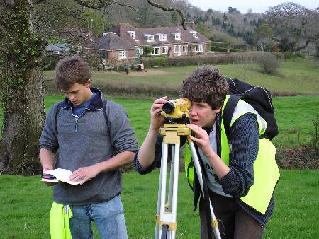
اولین مسابقه نقشه برداری


معاونت پژوهشی - گروه مهندسی نقشه برداری دانشگاه آزاد اسلامی واحد تفت اولین دوره مسابقات منطقه ای نقشه برداری ( المپیاد خلیج فارس ) با موضوعات ذیل برگزار می نماید:

گرایش ترازیابی با نیوو

گرایش زاویه یابی با تئودولیت

گرایش شبکه بندی با توتال استیشن

شرایط شرکت کنندگان دانشگاهی

تیم هایی که از طرف دانشگاه های مختلف دولتی و آزاد منطقه 4 ( استان های یزد، اصفهان و چهارمحال و بختیاری ) به این مسابقات اعزام می شوند، باید دارای شرایط زیر باشند

1. تعداد اعضاء هر تیم، 3 نفر می باشد و هر دانشجو می تواند فقط در یک تیم شرکت کند

2. تمام اعضاء هر تیم باید در زمان شرکت در مسابفه دانشجو باشند

3. تمام اعضاء هر تیم باید هم رشته در یک مقطع، از یک دانشگاه باشند

4. برای گراش ترازیابی و زاویه یابی، رشته اعضاء هر تیم می تواند کلیه رشته های فنی و مهندسی که دارای درس نقشه برداری هستند، باشد. اما برای شرکت در گرایش شبکه بندی با توتال استیشن، تنها شرکت توسط دانشجویان رشته نقشه برداری مجاز می باشد

زمان مسابقه: 10 اردیبهشت 1389

به منظور کسب اطلاعات بیشتر می توانید به سایت همایش www.sc89.ir مراجعه نمایید